TILMEN HÖYÜK


SITE AND HISTORY
The Tilmen Project
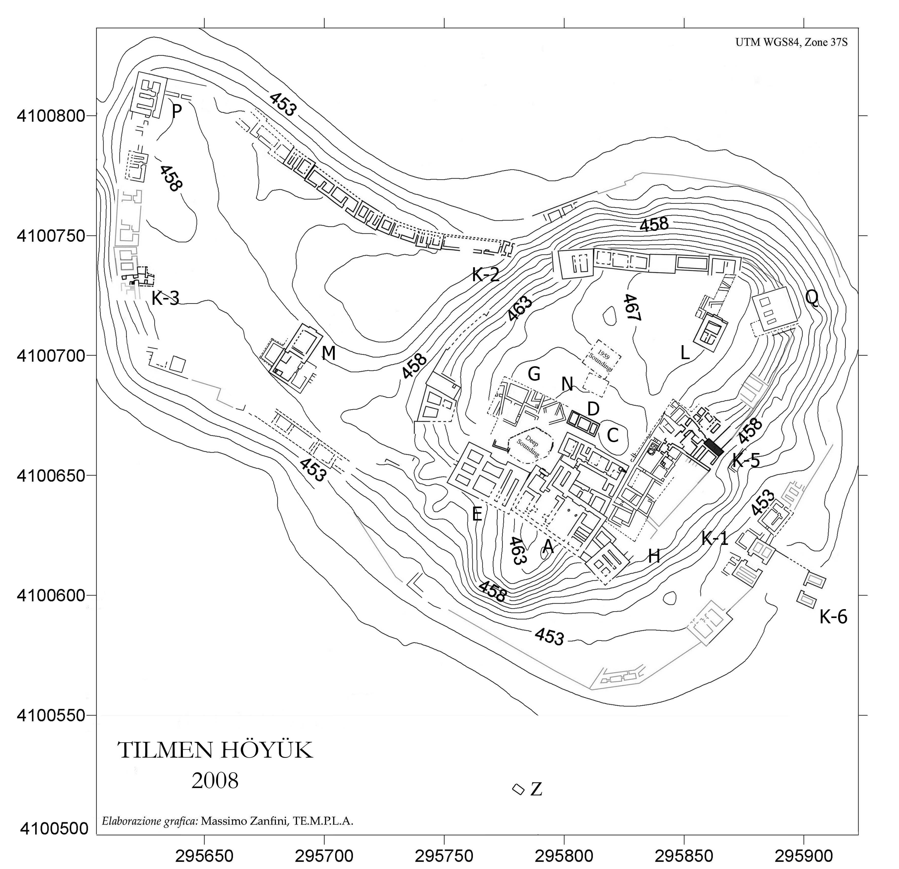
The Site of Tilmen Höyük
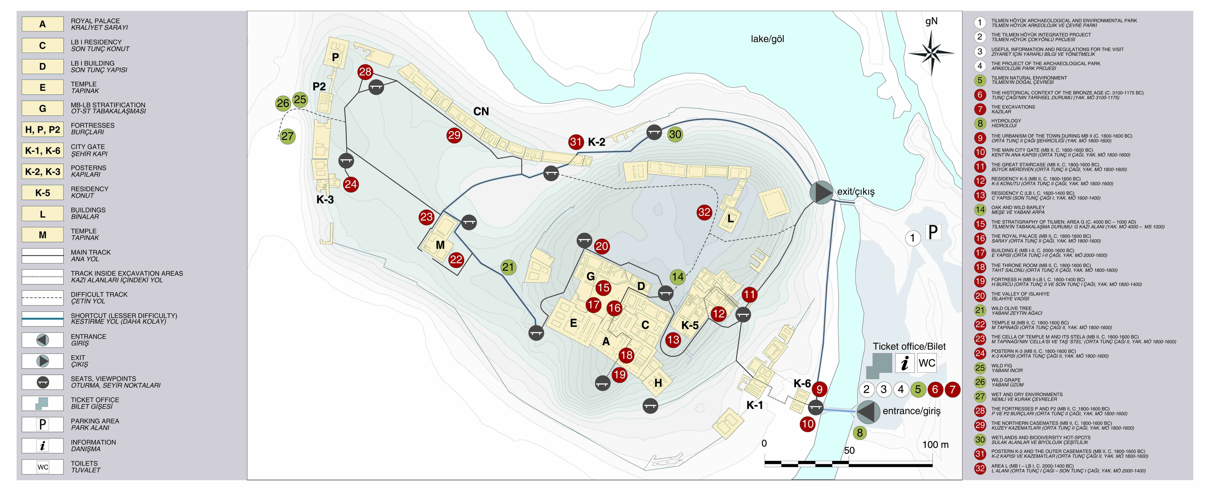
The 4.5 hectares large site of Tilmen Höyük (coordinates 37°1’48.49”N, 36°42’16.48”E) lies in the Islahiye valley (Gaziantep, Turkey), which connects the lower Orontes valley to the southern piedmont of central Taurus mountain range. During the Bronze age, the region belonged to the Inner Syrian cultural context, and held a highly strategic significance, over the course of time, for the connections between Upper Mesopotamian and Levantine lowlands on the one hand and the Anatolian highlands on the other. Settled since the Late Chalcolithic period, the city attained its major flourishing during the Middle Bronze II (c. 18th-17th centuries BCE), when it is probably to be identified with ancient Zalbar/Zalwar. Key evidence suggests that the site hosted also an Old Babylonian trading station, which was part of a network running from the Middle Euphrates to Cilicia and parallel to that of Ashur. With its massively walled lower town and fortified acropolis and its ‘Cyclopean’ architecture of basalt blocks, Tilmen Höyük is one of the most monumental cities of the area in that period.

LOWER AND UPPER TOWN
The archaeology of Tilmen
Lower Town Gallery
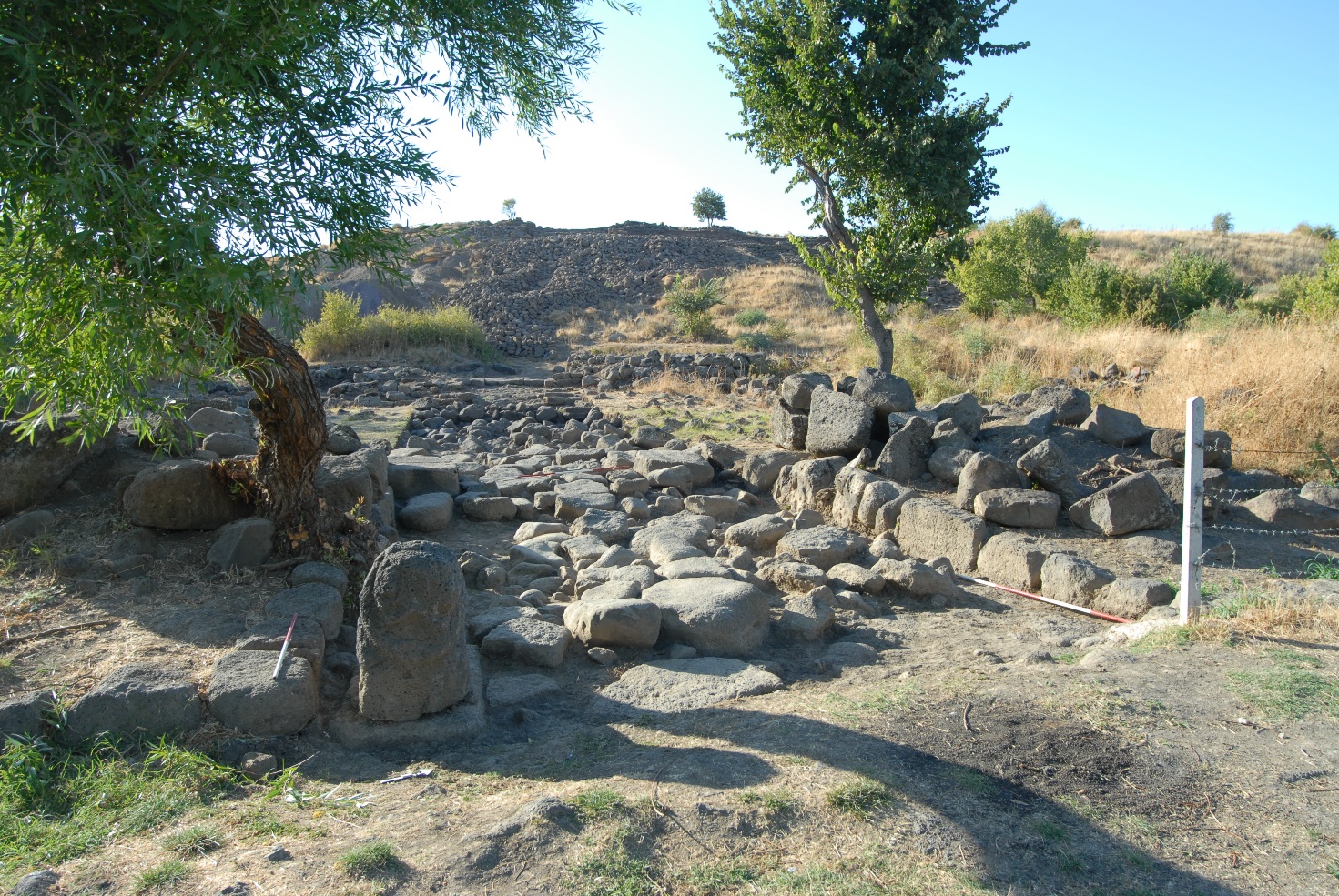
Area M
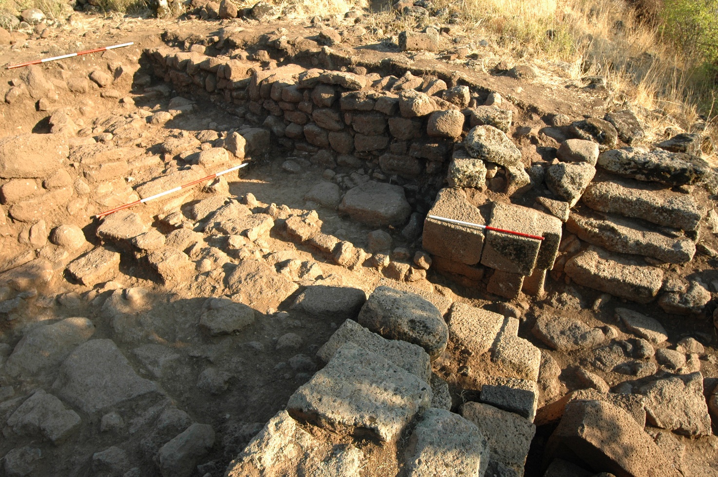
In Area M, located in the western sector of the Lower Town at Tilmen Höyük, a monumental temple with towers on the façade (in antis) of the Middle Bronze II has been exposed. Inside, a basalt stele was discovered, carved in a late Old Syrian style, depicting a high official making a prayer gesture in front of the Storm God. In front of the temple there is a temenos organized around two courtyards, with an entrance from the East, opening perhaps on a processional road coming from the acropolis. The area remained in use also during Late Bronze I.
Area M
In Area M, located in the western sector of the Lower Town at Tilmen Höyük, a monumental temple with towers on the façade (in antis) of the Middle Bronze II has been exposed. Inside, a basalt stele was discovered, carved in a late Old Syrian style, depicting a high official making a prayer gesture in front of the Storm God. In front of the temple there is a temenos organized around two courtyards, with an entrance from the East, opening perhaps on a processional road coming from the acropolis. The area remained in use also during Late Bronze I.
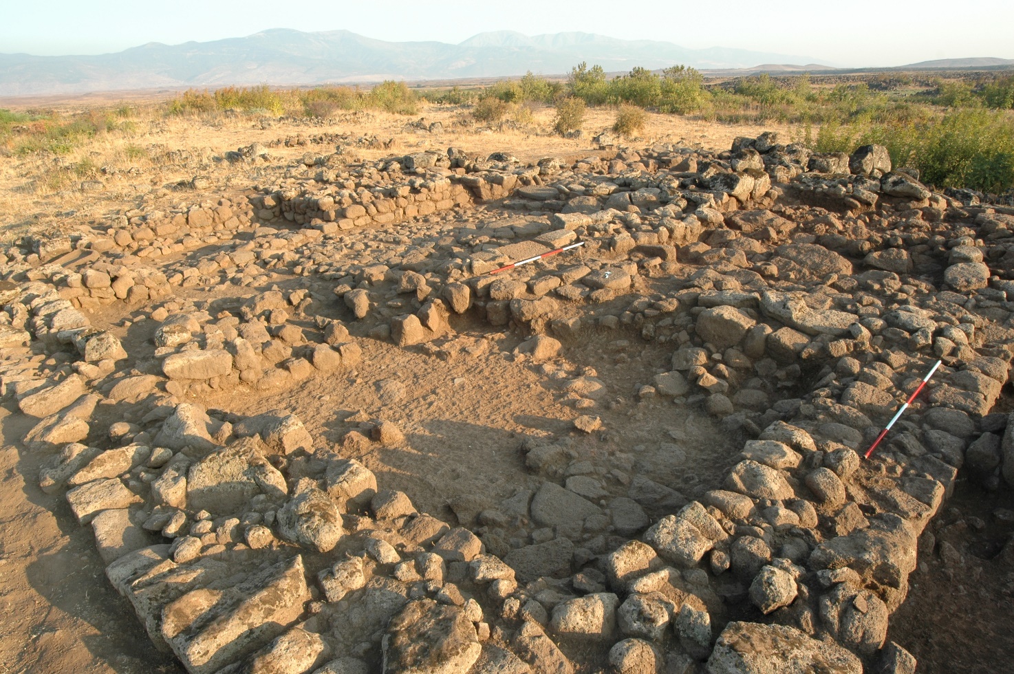
Area K-1 and K-6
The walls surrounding the Lower Town of Tilmen Höyük had an opening at about the middle of the eastern front for the monumental entrance of the Middle Bronze II, consisting of an advanced body (K-6) and a main gate (K-1) connected by walls. The two structures were separated by a courtyard: at least one basalt lion (probably two) sculpted in the round was placed along the outer gate, flanked by two towers. The main gate, with a single room, was also equipped with two towers. The access was regulated by two openings crossed by a covered drainage canal, while a double wooden portal blocked the outermost passage.
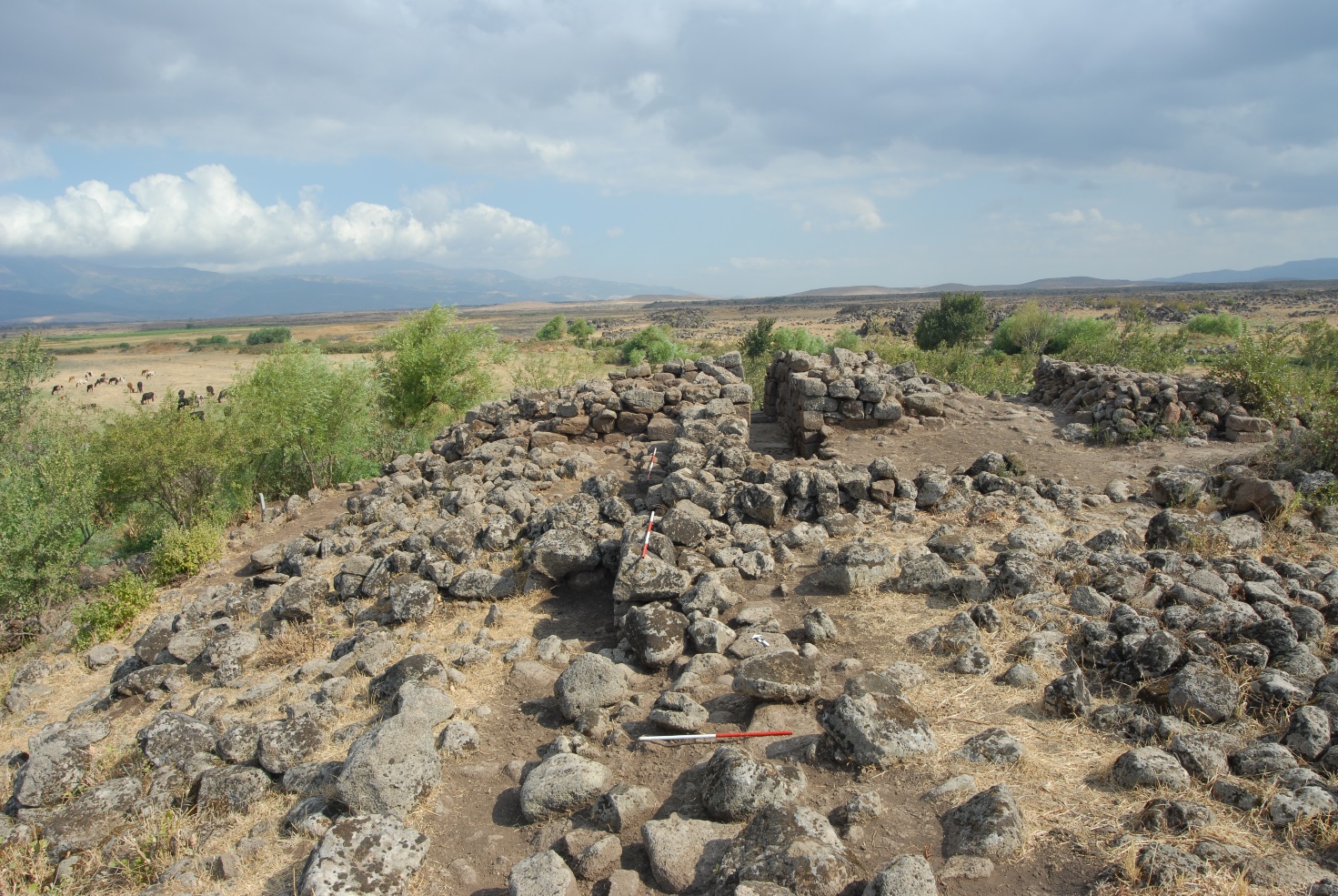
Area P
The tower-fortresses of Middle Bronze II Tilmen were a fundamental element of the urban defense system and were in close relationship with the casemate walls. Fortress P protected the north-western corner of the Lower Town casemate circuit. The access to the fortress, on the southern side of the structure, obviously opened towards the inside of the city. A corridor, which opened on one side onto two stairwells, led at its end to two square rooms, while monolithic thresholds marked the access to the different sectors. The fortress, after the destruction at the end of Middle Bronze II, was reoccupied during Late Bronze I. A little further south stands the fortress tower P2, which is in a worse state of preservation.
Areas K-3 and K-2
In addition to the monumental city gate K-1 and K-6, two other smaller passages were located respectively along the northern (K-2) and western (K-3) sections of the outer walls. Although both are characterized by the use of a rather accurate building technique, K-2 and K-3 did not have a monumental character, but rather constituted narrow posterns, unsuitable for the passage of carts or pack animals.
Area K-3 and K-2
In addition to the monumental city gate K-1 and K-6, two other smaller passages were located respectively along the northern (K-2) and western (K-3) sections of the outer walls. Although both are characterized by the use of a rather accurate building technique, K-2 and K-3 did not have a monumental character, but rather constituted narrow posterns, unsuitable for the passage of carts or pack animals.

The casemate fortification system
The Middle Bronze II city was characterized by a partition into acropolis and lower city, both surrounded by their own circuit of casemate walls. These walls were made up of a series of rooms, which were positioned side by side and created a continuous external front joined at intervals by fortresses located in strategic defense points. The remains of long stretches of the outer wall, which continued around the lower town for more than 900 meters, are clearly visible on the surface, especially in the northern part excavated by the Turkish expedition.


Area R
Around the Lower Town, areas R, V and Z provided important information regarding the organization of the outskirts of the city during the Middle Bronze Age. Area R is located on a basaltic ridge to the North-East of the Karasu river. In fact, a surface survey of the area has revealed a conspicuous stone wall that ran along the modern artificial lake, perhaps connected to the city defensive complex or to some sort of control system of the watercourse. About 150 meters to the North of the ridge, an ancient road and a small Middle Bronze I necropolis have been identified.
Area V
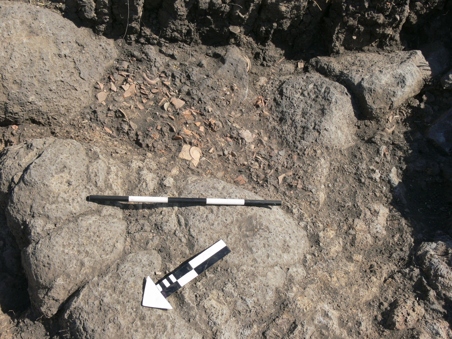
Area V is located West of the Lower Town, in correspondence with a section of the basalt plateau that had been the subject of a series of illegal excavations. Although no structures have been found that can be attributed with certainty to a funerary sector, investigations have revealed traces of ancient open-air refuse areas, perhaps in connection with production activities, dating back to the beginning of the Middle Bronze Age.

Area Z
Area Z is located South of the main mound and has been subjected to an emergency intervention following some agricultural digging activities. An open-air area, to be interpreted probably as a working area, dating from the early Middle Bronze Age with plenty of miniaturistic ceramic forms was brought to light.
Repository
The Tilmen Höyük Lower Town materials database (2004-2007, Pottery, Small finds, Samples)
Islahiye-Gaziantep
The archaeological Park
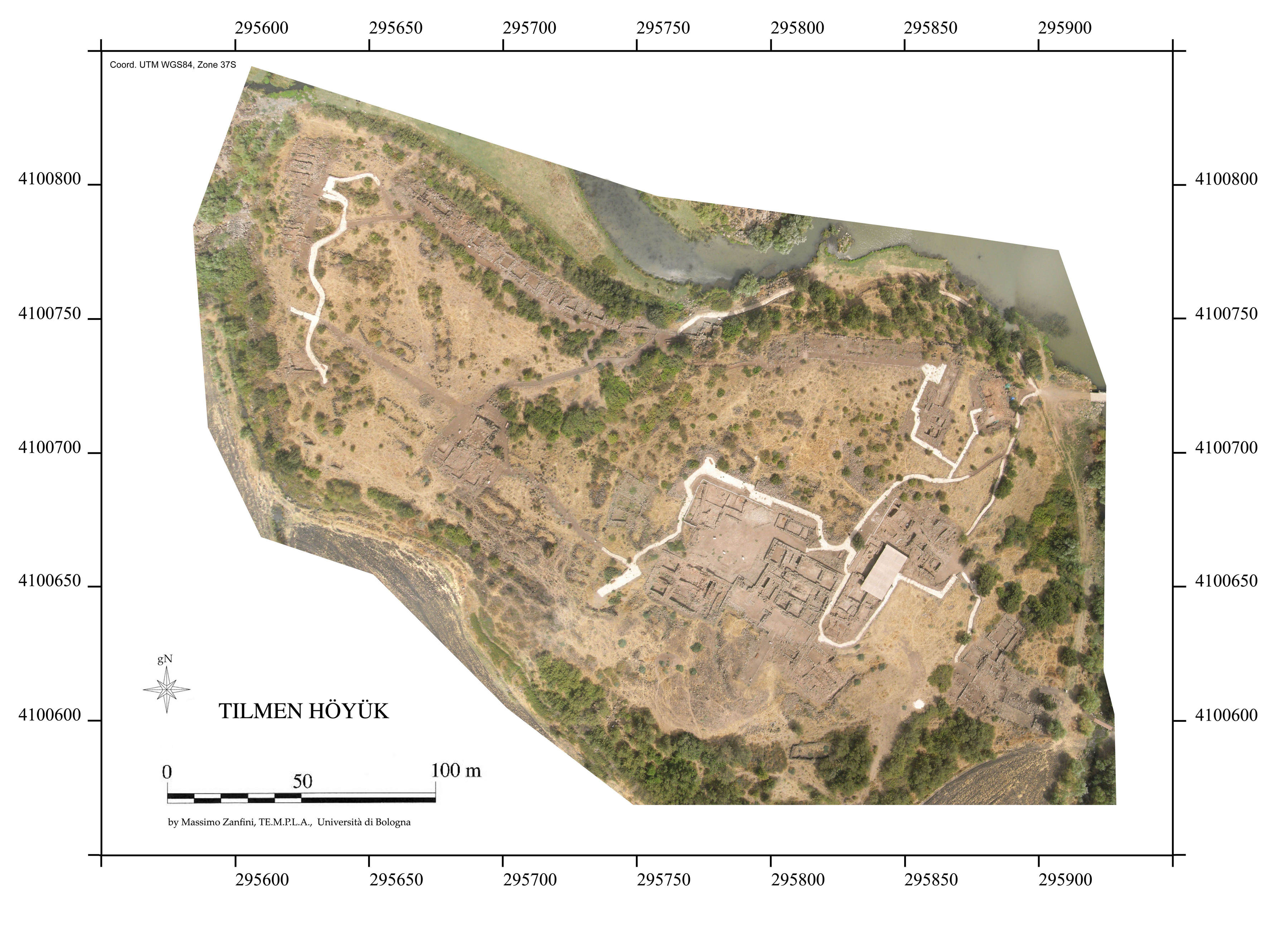
Orthophoto

Access to the palatine area on the acropolis, east view

Karasu River, south-east view

The Acropolis at sunset

Route leading to the acropolis at the base of K-5, north-west view

Residence C with panel, east view

The ancient square along the southern part of the acropolis, south-east view.
Credits and Publications
Credits
The Tilmen Project is directed by Nicolò Marchetti of the Alma Mater Studiorum – University of Bologna. Archival holdings of the expeditions at Tilmen Höyük by the Universities of Bologna and Istanbul (Scientific director Refik Duru) have been used in this the project.
The project has benefited from funding by the University of Bologna, the Italian Ministry for Foreign Affairs (DGSP 6th office) and the Italian Ministry for University and Scientific Research (PRIN and FIRB programs). The support of the Turkish Directorate General for Cultural Heritage and Museums and Gaziantep Museum is gratefully acknowledged.
The website has been conceived by Nicolò Marchetti (Scientific Editor), with Pietro Baldassarri (Web Engineer) setting up the MySQL database and Valentina Orrù (Web designer and Webmaster) managing the Tilmen Project website. We gratefully acknowledge the CRANE 2.0 project for having provided the server on which our webGIS is running.
The Lower Town Publication Project
The publication project of the excavations in the Lower Town at Tilmen Höyük is funded under The Shelby-White and Leon Levy Program for Archaeological Publications, Harvard Semitic Museum, Harvard University (recipient: Valentina Orsi, University of Siena 1240, Department of Historical Sciences and Cultural Heritage). Reports on the excavations in the Lower Town at Tilmen Höyük, undertaken between 2003 and 2008 by the Turco-Italian Expedition directed by N. Marchetti, are published in the GRPOP and OrientLab peer-reviewed series.